Falls and Spamalot at In-N-Out Burger

Now everybody has got the choice between hotdogs and hamburgers

Day 18, Fuller Ridge to Interstate 10

Wednesday, April 10, 2019

The last four days had been challenging. The trail had climbed from 4,000 feet to 9,000 feet in elevation, where we then walked through several miles of snow. Along the way we were battered by wind.

Today would be our reward. The trail was either downhill or flat the entire way. Waiting for us at the end were all the conveniences of modern life: fast food and Walmart, Ubers and motel rooms.

We were going to have it all.

Weather Clear skies with a high temperature in the mid 60s
Trail Conditions Easy, downhill path broken by a few washout sections, then road walking and a long section of sand
Today's Miles 12.3 miles
Trip Miles 209.5 miles

The wind we were trying to avoid last night suddenly ended around midnight. This allowed me to sleep soundly.

I awoke early, then had plenty of time to prepare for the day’s hiking.

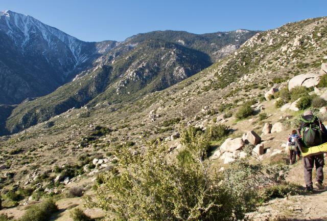
Walking down Fuller Ridge

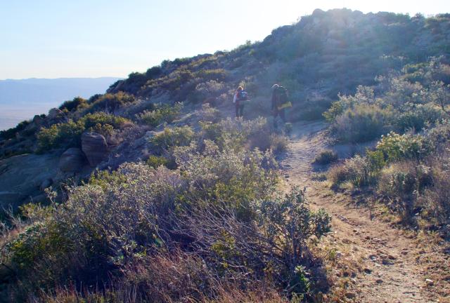
We left camp at around 7:15 a.m. and continued our long descent down Fuller Ridge.

From the top of the ridge yesterday to the bottom today, we will go down more than 6,500 feet.

The trail makes a wide turn

The drop never seemed steep, though, because there were many switchbacks and turns along the contours of the ridge.

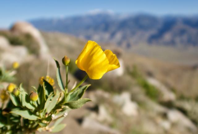
Mojave gold poppy

The farther down the trail went, the more wildflowers appeared. The first to show were Mojave gold poppies.

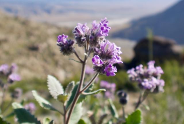
Hairy yerba santa

In one segment of the trail, hairy yerba santa were plentiful.

This variety of wildflowers is part of the boraginaceae family, one of the largest plant families found in the United States. However, the pale purple hairy yerba santa are only found in a relatively small area of Southern California on the west side of the Mojave and Sonoran deserts.

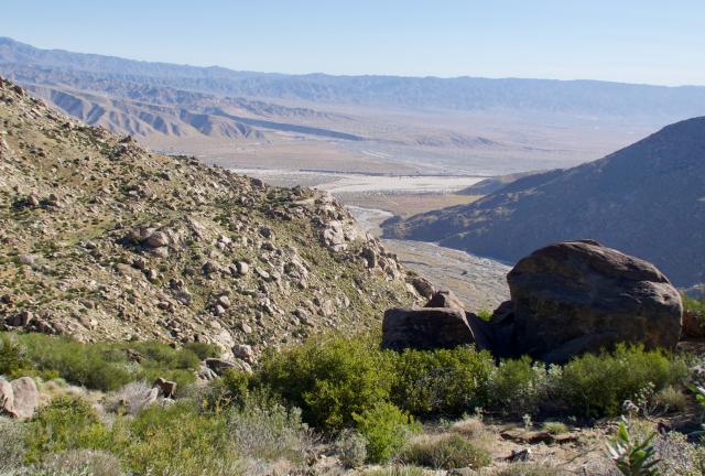
View of Coachella Valley

When I wasn’t looking at flowers, I was looking at views of the Coachella Valley.

The valley’s name is a mis-spelling of “conchilla,” which is Spanish for “little seashell." Fossilized mollusk shells are said to be found there because the area was once a an inland sea.

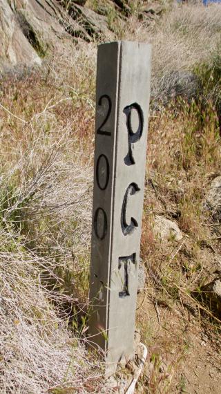
PCT marker for 200 miles

After nearly three miles of walking I passed a marker indicating the 200-mile point of the trail. Or at least that was the claim. The correct spot was about two tenths of a mile away.

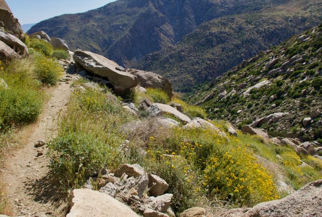
More yellow flowers

More yellow flowers appeared farther down. They lined both sides of the trail and among the rocks.

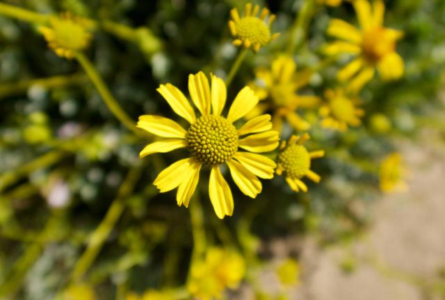
Ragleaf bahia, also known as yellow ragweed

Many of these were ragleaf bahia, also known as yellow ragweed.

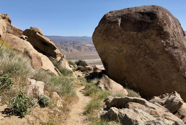
Giant boulder

Besides the many clumps of flowers, there were large boulders. Some were larger than a car.

I passed so many that at one point I thought I had passed the same boulder twice.

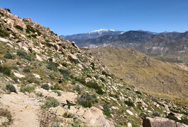
View of San Gorgonio Mountain

On the other side of the desert stood San Gorgonio Mountain, which was capped in snow. Fortunately, the trail doesn't go near the mountain enough to go through the snow.

I was glad to know that. I feel I’ve had enough snow for a while.

At one point I met a backpacking couple who were from the area. They told me that more snow fell in the Sierra just last week.

This was not good news because that area had already received more than 200 percent of normal snowfall. The trail was heading that way and I had hoped the snow there would begin to quickly melt, not add more.

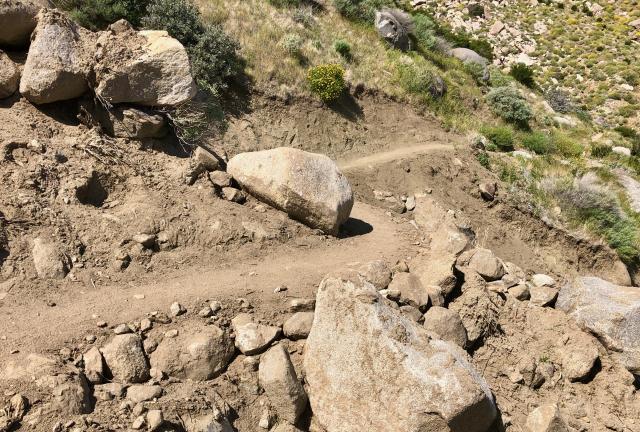
Repaired trail

In several spots on the lower end of the trail there were washed out sections. The trail had been damaged by heavy rain that fell in the area a couple months ago.

Some sections appeared to have been recently repaired, but in a couple locations I had to step carefully over the washout to reach stable trail.

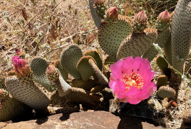
prickly pear cactus

Nearing the desert floor, cacti began to appear. Some were prickly pears, which were in bloom.

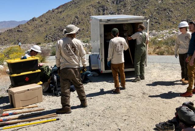
Trail maintenance crew

After four hours of walking I reached a water faucet and parking lot. A trail crew from American Conservation Experience was there. The team members were unloading tools and preparing to return to repair more of the washout damage.

Spamalot and Falls

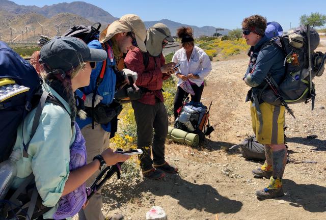
Spamalot and Falls were also there, now recovered from the flu. They had hired a ride from Idyllwild yesterday and hiked up the trail to near this spot, where they waited to meet us.

It was good to be a reunited tramily.

Woo-hoo Crew walking

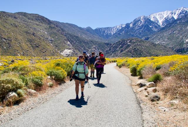
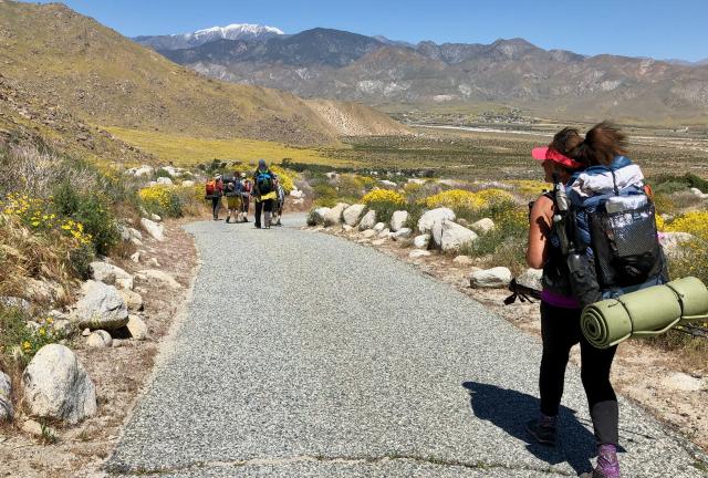
Once hugs were exchanged we lifted our packs again and began walking down the trail toward Interstate 10. Starting out, the trail was paved, like a narrow road.

Along the way we encountered a large rattlesnake, which was luxuriating in the warmth of the pavement. It didn’t appreciate our presence and let us know that with a stern rattle. The path was wide enough that we were able to steer clear without trouble.

Walking on paved trail

Now the trail was lined with even more yellow wildflowers. Most were yellow ragweed.

This continued beyond the end of the paved section, where the trail then followed a road before turning off on a sandy footpath across the desert plain.

Desert sand

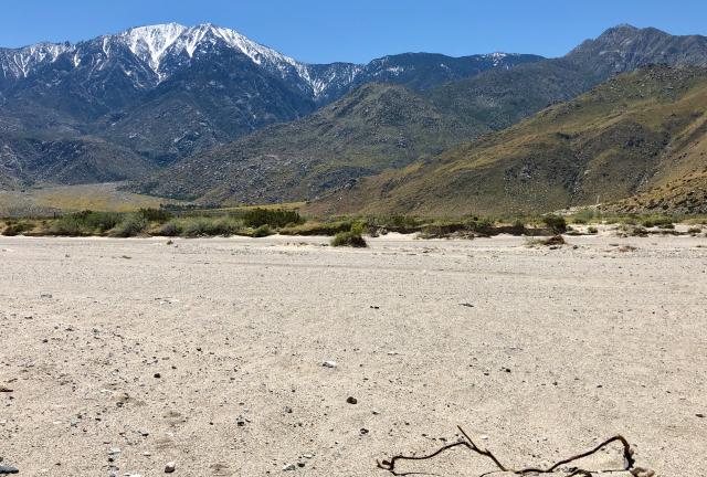
As we neared Interstate 10, the trail disappeared. Instead of a recognizable footpath, we found a wide expanse of sand. It was miserable to walk on.

Dry river bed

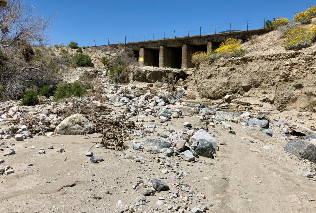
Things became worse when we neared a railroad bridge next to the highway. The trail crossed a dry riverbed, which was a jumble of sand, rocks and debris.

Actually, to say the trail crossed this riverbed is an overstatement. There still wasn’t a real trail. We had to guess at the best route.

It seems there may have been a marked trail here at one time, but this section was impacted by the same storm that caused damage on Fuller Ridge.

Trail magic

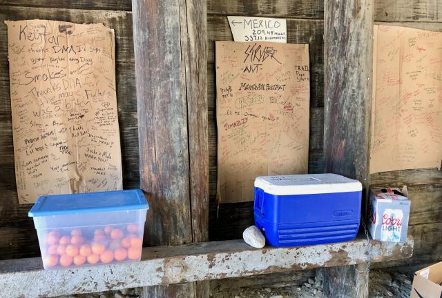
Once we were in the shade of the bridge we discovered a large cache of trail magic. Fruit and cold drinks were left there by kind volunteers.

At this point, we didn’t have much of a plan except for one: get a couple Uber drivers to take us to In-N-Out Burger.

Ordering an Uber

Getting an Uber from here was easy. We made a short, steep climb up an embankment to a service road next to the interstate.

Many drivers roam this area because it’s between Palm Springs and Cabazon, where a large casino is located. The drivers also seemed to know how to get to the service road because it is common for hikers to want a ride from here.

Because of the size of our group, we needed two drivers. The first driver was soon followed by the second.

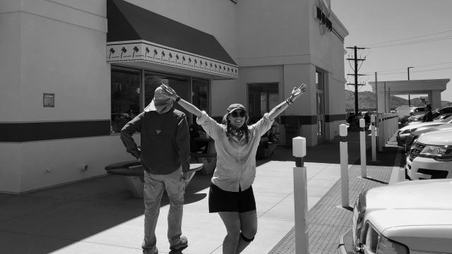
Within minutes we were at In-N-Out Burger, which was located in a service plaza near the casino complex. When some of the hikers saw that a Panda Express was also there, they decided to skip the burgers and go for Chinese food.

This was the first fast food I’d had since getting on the trail and the first time I’d eaten at In-N-Out Burger. I was somewhat underwhelmed.

We gathered again at Panda Express to figure out a plan for the rest of the day. With the help of Google Maps, I discovered there was an inexpensive Rodeway Inn motel within walking distance of a Walmart and a laundromat. These would satisfy our next objectives for today.

The motel was located in Beaumont, a town about 10 miles away on the interstate. Everyone liked that idea, so we ordered a couple more Ubers to take us there.

While making reservations, I discovered the motel only had two rooms. We would have to cram all eight of us into the two rooms, but this was no problem. It’s the kind of thing thru-hikers take in stride.

There were still many chores to complete for the remainder of the day. After showering, Tengo, Spamalot and I walked to Walmart, while the others took an Uber. Tengo and I also walked to Big 5 Sporting Goods so I could buy a fuel canister and he could look for a replacement for his broken trekking pole.

Once we became loaded down with groceries, we decided to take an Uber back to the motel. Then we did laundry and organized for returning to the trail tomorrow.

We decided to end the day across the road from the motel at Marla’s Mexican Restaurant. This was the only decision of the day I would regret, though the regret was yet to come.
Now everybody has got the choice
Between hotdogs and hamburgers
Every one of us has got to choose
Between right and wrong
And givin' up or holdin’ on

This trail report was published on